Location and Geology
The Buntine Project is located approximately one hundred kilometres southeast of Lake Argyle in the Northern Territory, Australia. Its granted exploration licences cover 1,876 square kilometres and are 100% owned by Barkly Rare Earths Limited.

The project area includes overlies the Birrindudu Basin. In the majority of the tenement package, the Birrindudu Basin is dominated by rocks of the Limbunya Group, including the 1642 ± 4 Ma Fraynes Formation, which is chronographically equivalent to the Barney Creek Formation that hosts the McArthur River Pb-Zn deposit. The two formations are likely linked in the subsurface, making the Fraynes Formation a target for greenfields base metal exploration.
Refer to Sections 4–9 of the Independent Technical Assessment Report at Annexure A of the Prospectus for detailed geological information and full disclosure of the summary information, below.
Mineralisation
Barkly Rare Earths Limited has identified anomalous polymetallic Zn, Pb, Co, Cu, and Mn mineralisation in exposed Palaeoproterozoic sedimentary rocks along a 9-kilometre strike length of north-trending Blue Hole Formation (Mesoproterozoic siliciclastic rocks) and overlying Cenozoic sediments. Refer to the rock-chip sampling maps, below.
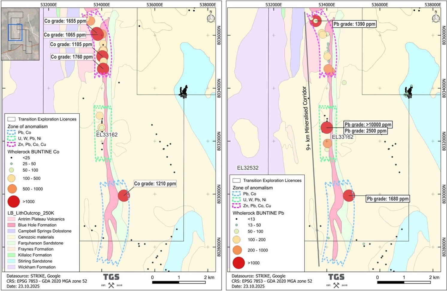
The Company has identified three different anomalous zones of Pb-Co, U-W-Pb-Ni, and Zn-Pb-Co-Cu along the mineralised corridor, with various historical rock chip samples grading up to 667 ppm Zn, 1% Pb, 1760 ppm Co, 316 ppm Cu, 10% Mn, 7,100 ppm Ni, and 239 ppm Cr. These will be followed up in a planned exploration program including rock-chip sampling and geological mapping throughout the Buntine tenements.